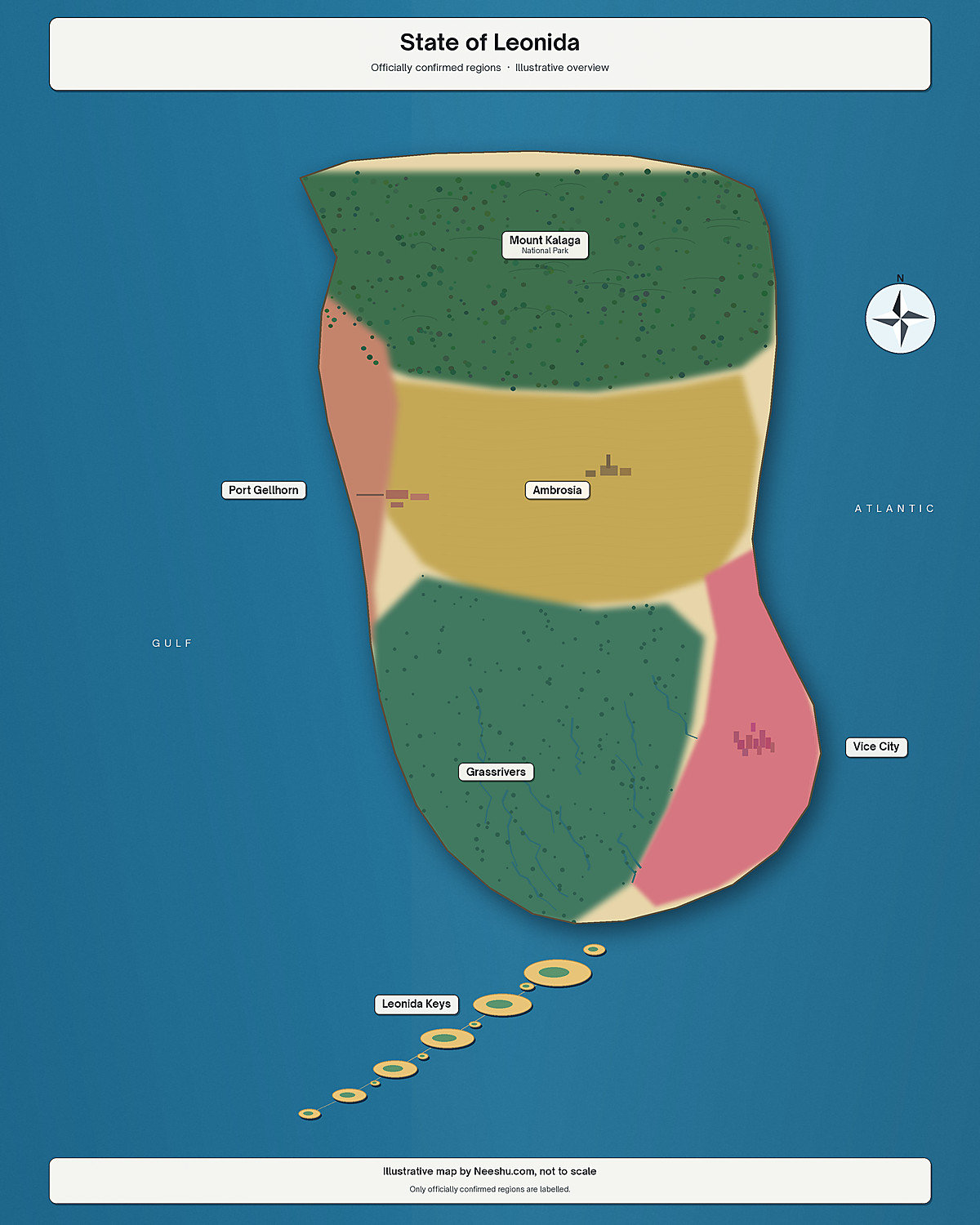
The map for Grand Theft Auto VI is called the ‘State of Leonida’, and the game was released on the PS5 and Xbox Series X|S on 19 November 2026. Rockstar Games have named 6 regions in Leonida, however have not given specific information on the size of the map in km². Rockstar staff comparisons reported by various sources (IGN, Kotaku, VGC, GameSpot) give a sense of scale, alongside findings from players in the first few hours of gameplay.
Quick answer: what is the GTA 6 map?
The GTA 6 map is known as Leonida. Within the official website, and the launch preview on PlayStation, the 6 regions are Vice City, the Leonida Keys, Grassrivers, Port Gellhorn, Ambrosia and Mount Kalaga.
There is a map in-game. It was noted by GameSpot (as the game unlocked in New Zealand and Australia) that there is a ‘fog of war’ mechanic, similar to previous games. Once areas are explored, they become more detailed. Rockstar says a free printable cover-art poster and map of Leonida will be made available on the official GTA VI website on 19 November. A double-sided physical poster can be purchased from the Rockstar Store for $0.99, or included free with any purchase from the store (Metro, GameSpot). However, when searching for a printable map on the morning of 19 November 2026 in India, there was no immediately obvious one; the downloads page had trailers, screenshots and artwork. We recommend checking rockstargames.com/VI yourself. Avoid randomly found map files which claim to be ‘official map’ from other websites.
Grand Theft Auto VI is now officially only two weeks away.
— Rockstar Games (@RockstarGames) November 5, 2026
Today, enjoy a stunning look at Vice City and beyond with a collection of new screenshots on the official site: https://t.co/nX2McNaJNE
See you in Leonida on November 19. pic.twitter.com/JXkHN8r20Y
The six official regions, and the Florida they echo
Below is information on each of the 6 regions, taken from the official Only in Leonida page, and the launch post on PlayStation.
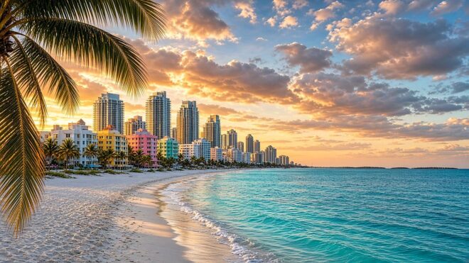
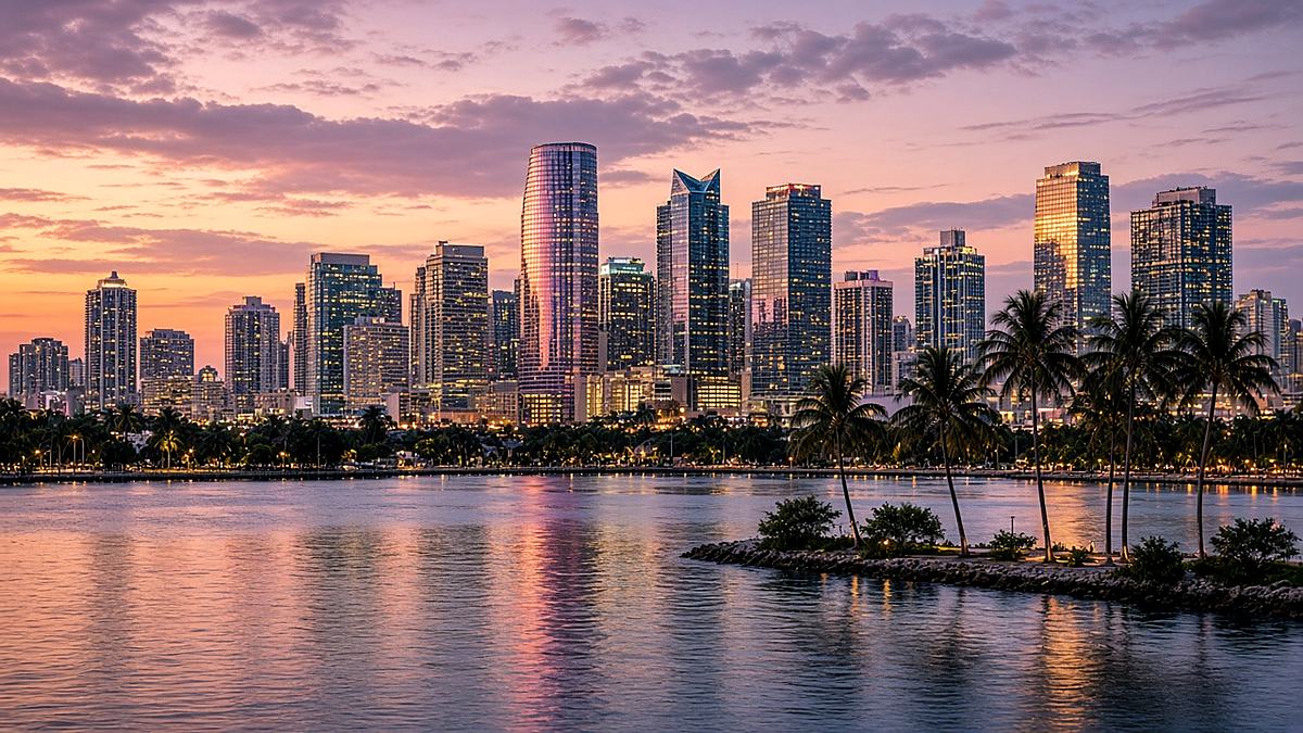
Vice City is the main urban area. Rockstar calls it the sun and fun capital of America. It’s a long way from the 1980s version: think pastel art deco hotels and white sand at Ocean Beach, panaderías in Little Cuba, and the Tisha-Wocka flea market. It also contains VC Port, known as “the cruise ship capital of the world.” It essentially represents Miami. Ocean Beach is representative of South Beach, and Little Cuba is the official name (rather than Little Havana).
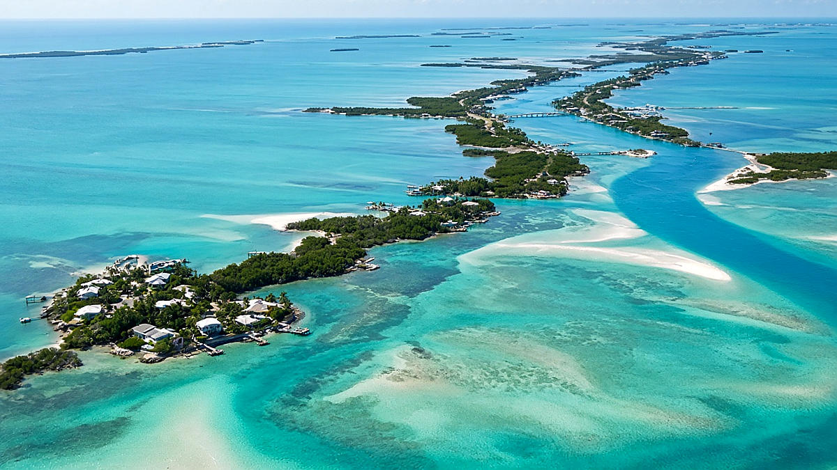
The Leonida Keys are the relaxed tropical island region. It sits on the edge of “some of the most beautiful and dangerous waters in all of America.” This region represents the Florida Keys. GameSpot compared the southern tip with the real Key West. Within official character bios, Jason was previously in the Keys working for local drug runners.
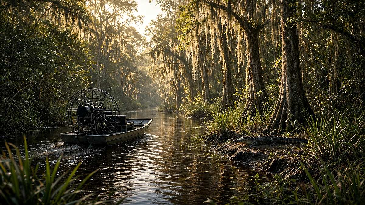
Grassrivers is a swampy region of mangroves. Although famed for alligators, much more deadly predators and strange findings can be found below the surface. This region essentially represents the Everglades.
Port Gellhorn is a run-down resort area. It contains cheap motels, closed attractions, empty strip malls and a new local economy “fueled by malt liquor, painkillers, and truck stop energy drinks.” This is a worn-out tourist area in Florida. This area is not a second Vice City. Within some community maps, this region is on the Gulf side. Treat these placements as estimates. Wait until you open the in-game map to find the exact location of the region. Rockstar have not published a labelled map of regions.
Ambrosia sits “in the heart of Leonida.” Employment comes from the Allied Crystal sugar refinery. A local biker gang “provides almost everything else.” This is a classic sugar-industrial region within Florida, although the town name was invented.
Mount Kalaga is a national landmark against the northern border, popular for hunting, fishing and off-road trails. Backwoods communities live “far from the prying eyes of the government.” In official postcard artwork, this region is known as Mount Kalaga National Park.
Many other names can be found online. These are largely from spotting regions in trailers and community maps. If a region/area is not mentioned on the official site, in-game, or by a reputable source, then consider it to be unofficial.
How big is the GTA 6 map compared with GTA 5?
Rockstar Games do not give an official km² size for the map. Therefore any estimations of 75, 90, 120 or 150 km² are community estimates or guesses, not official measurements.
After a studio preview in August 2026, Rob Nelson (Rockstar North) gave size comparisons to YouTuber TGG. This was reported by IGN, Kotaku, and Video Games Chronicle. The total size of the map is approximately double the size of GTA 5 and about triple the playable area of Red Dead Redemption 2. Vice City alone is double the size of Los Santos. However, if combining Vice City and its surrounding suburbs, the area becomes 11 times larger than Los Santos and its surroundings.
Grand Theft Auto 6's map is significantly larger than previous Rockstar games, with GTA 6's Vice City being twice the size of the city of Los Santos and San Leonida's suburbs being 11 times larger than GTA 5's. https://t.co/slSpSLMSYl pic.twitter.com/TAMLjuDSgG
— IGN (@IGN) August 28, 2026
GameSpot reports that Rockstar told Edge magazine that the total landmass of GTA 6 is nearly as big as the playable maps of GTA 4, GTA 5 and Red Dead Redemption 2 combined. Co-studio head Aaron Garbut mentioned that the game has “an order of magnitude more interiors” than any previous Rockstar title. There are “hundreds” of accessible interiors (IGN, citing TGG). No official total of 700 exists, and there isn’t any other exact figure either. On 18 November, GameSpot timed a flight in a single-propeller plane taking 4 minutes and 10 seconds to cross the map.
Best interactive GTA 6 maps
Official. The map within the game, where more detail becomes visible as areas are explored. Rockstar said a free printable poster and map of Leonida would go up on the official site on 19 November. Look for it from the official GTA VI page, or the downloads section. A double-sided physical poster was also promised on the Rockstar Store shortly after launch. Descriptions of each area can be found in Only in Leonida.
Unofficial/Community. This interactive map of the State of Leonida is a fan project. It clearly states that it is not affiliated with Rockstar or Take-Two. This GTABase map can be filtered and used to track collectibles. Both maps can be useful to plan your route through the map. However, the markers may be inaccurate, or ahead of what you have unlocked. Within the game, use the in-game map.
State of Leonida interactive fan map, not affiliated with Rockstar or Take-Two. If the embed does not load, open the link in a new tab.
The GTA 6 Map Is Truly, Truly Massive (Of Course) dlvr.it/TWNZc4 pic.twitter.com/v1SSHo9IYX
— GameSpot (@GameSpot) November 18, 2026
The leaked GTA 6 map (unconfirmed)
Unconfirmed leak. A map said to be leaked from GTA 6 is circulating on X. It shows county names such as Lummox, Kelly, Leonard, Vice-Dale and Mariana, and one large Vice City area surrounded by wilderness. Rockstar has not confirmed it, so treat it as rumour until the official map is out.
If the leaked maps coming out are real, then it looks like the stuff about GTA 6 being "a 3 city state like San Andreas but it's not-Florida instead of not-California" turned out to be overhyped. It's looking more like the GTA V model of one big city plus surrounding wilderness… pic.twitter.com/PwRnReTHZm
— TNG5 (@TNG512) November 18, 2026
Where to go first, and a few practical tips
As Rockstar Games have not specified an order in which to explore the map, we will not be providing one. Start in Vice City. The officially named anchors within Vice City are Ocean Beach, Little Cuba, Tisha-Wocka and VC Port. Next, get used to navigating on water. In the Keys and Grassrivers, large distances will need to be travelled by boat. If you stick to driving in a sports car, you will miss half of the state!
Outside of cities, make sure to select the correct vehicles. In Grassrivers, as it is a wetland, in Mount Kalaga (hunting/fishing/off-road), and in Port Gellhorn and Ambrosia (smaller towns). Throughout the map, try to open your in-game map frequently. As locations are discovered by driving along new roads, they will appear in focus due to the fog of war.
For release times, review scores, and how to utilise game share on the PS5, check out our GTA 6 launch guide. It also includes information that GTA 6 is not available on PC at release.
What the community has already found
Once the game unlocked in New Zealand, GameSpot included a clip from streamer N3on showing the full in-game map. Many people got their first look at the whole state in this manner. However, not all roads and shops will be visible immediately. Community maps allow for an early look at the map, however they were created by fans. If a post states a specific km² for GTA 6, ensure you check where this information has been taken from. No official size has been released by Rockstar Games.
FAQ
Is there an official GTA 6 map?
Yes, in the game. Once explored, areas will be detailed. The free printable poster and map should be available on the official site on 19 November 2026, according to Rockstar. A cheap physical poster should arrive shortly after release. There is not an official interactive map for this game online.
How big is the GTA 6 map?
No km² figure has been given by any Rockstar staff. However, Rob Nelson gave size comparisons to TGG (as reported by IGN, Kotaku and VGC): the map is roughly twice as big as GTA 5, and about three times the playable space of RDR2. Vice City is twice the size of Los Santos.
What is the GTA 6 map called, and what regions are in it?
State of Leonida. 6 regions: Vice City, the Leonida Keys, Grassrivers, Port Gellhorn, Ambrosia and Mount Kalaga.
Is GTA 6 on PC? Can I visit Los Santos or Liberty City?
No. At release, this game is only available on PS5/Xbox Series X|S. There is no information from Rockstar as to when it will be on PC. Los Santos and Liberty City are from previous games and will not be found within this map.
Where can I see a map?
In-game map first. Rockstar’s official site is where the printable one is promised. If you want to interact with it, check out community made maps: State of Leonida or GTABase.
Grand Theft Auto, GTA, GTA 6, GTA VI, Vice City, Leonida and Rockstar Games are trademarks of Take-Two Interactive Software, Inc. and/or its subsidiaries, including Rockstar Games. This site is an independent fan guide. The unofficial maps from the community linked to from this page are not affiliated with Rockstar or Take-Two.